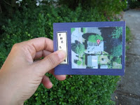


A friend of mine took a trip to Washington D.C. and brought me back a pop-out tourist map. Since I am a huge fan of anything pop up, I tried to recreate this map. In Adobe Illustrator, I made a document delineating all the fold lines I would need. Using a light table I looked through the map to see the score marks and note all the measurements. I searched for the address of my choice in Google Maps and printed it on white cardstock. I do a lot of hand cutting of my paper designs, but in this case I wanted it to have very precise score marks. I used my CraftRobo ( a cutting plotter ) and had it automatically score all the lines I had designated. It was easy to fold as long as I kept track of which lines folded in (valleys) and which lines folded out (mountains). A satellite photo of the house at the address added that finishing touch!


No comments:
Post a Comment
Share your ideas and reflections